


Metar-Taf is a comprehensive weather application designed specifically for aviation enthusiasts and professionals. The app provides visualized METAR and TAF weather information for airports worldwide, presenting data in easy-to-understand, colorful metrics. With features like crosswind calculations, flight rules categorization (VFR, MVFR, IFR, LIFR), and text-to-speech functionality, users can efficiently decode and listen to METAR reports while multitasking.
In addition to current weather conditions, Metar-Taf offers detailed forecasts through its TAF feature, breaking down Terminal Aerodrome Forecasts into hourly tables and displaying sunrise/sunset times and temperature extremes. Users can track their favorite stations, access observations near their location, and search airports by ICAO code or name. The app also includes historical weather trend graphs, customizable units for various measurements, and offline data availability, making it an indispensable tool for anyone involved in aviation.
Metar-Taf stands out with its extensive range of specialized features tailored for aviation weather tracking. The app's METAR visualization transforms complex weather data into intuitive graphics, complete with symbols for significant weather patterns and cloud formations similar to non-aviation weather reports. Its unique crosswind calculation combines runway information with METAR data, providing pilots with crucial takeoff and landing insights.
The TAF breakdown goes beyond simple forecasts by presenting detailed hourly weather predictions alongside important daily metrics such as temperature variations and sunrise/sunset times. The app's comprehensive airport information system includes runway directions, elevation data, and precise location details. Furthermore, Metar-Taf's advanced customization options allow users to personalize measurement units across various parameters including speed, altitude, visibility, temperature, and air pressure, while automatically converting times to local airport time zones.
Accurate weather forecasting is crucial for aviation safety and planning. Metar-Taf provides visualized METAR and TAF data, ensuring pilots have reliable information at their fingertips.
The application breaks down complex meteorological data into easy-to-understand metrics and symbols. This includes significant weather patterns and cloud formations, similar to non-aviation weather reports, enhancing comprehension and decision-making.
Users benefit from precise calculations such as crosswind components and flight rule categorizations like VFR, MVFR, IFR, LIFR. These features ensure that aviators can make informed decisions based on credible and timely weather data.
With text-to-speech functionality, decoded METARs can be listened to while multitasking, further emphasizing the app's commitment to accessibility and accuracy in delivering critical weather updates.
Understanding both temporal and spatial aspects of weather forecasts is essential for effective aviation planning. Metar-Taf offers detailed breakdowns of TAF data per hour, providing comprehensive insights into expected conditions throughout the day.
The app displays sunrise and sunset times alongside minimum and maximum temperatures, allowing users to anticipate daily weather fluctuations accurately. This granular view helps pilots prepare for varying conditions they may encounter during flights.
By integrating an interactive map with weather codes, users can quickly locate stations near them or search by ICAO code or name. This spatial awareness ensures that aviators are always aware of nearby weather patterns, enhancing situational awareness.
Additionally, historical graphs showing trends over the last hours offer valuable context about changing weather patterns, enabling better strategic planning and risk assessment for upcoming flights.
User-friendly interface
Comprehensive weather data
Offline functionality
Multilingual support
Customizable units
Specialized aviation focus
Complex for casual users
Premium features locked
Occasional data delays
Resource-intensive

Personal Weather Station PRO - Meteo monitor to check your WU info and charts.
 4.20
4.20
Get instant weather & temperature predictions right on your Wear OS smartwatch!
4.3
Accurate Thermometer: indoor & outdoor temperature, humidity, pressure, and wind
4.50
Weather - Local weather forecast, weather daily & hourly, weather radar
4.80
Weather radar, hyperlocal tracker and weather maps: follow your weather station
4.80
Weather radar, satellite, wind, waves, ocean and hurricane forecasts.
4.70
Weather watch face for Wear OS 5+
4.10
Check room temperature with this indoor thermometer. thermostat & hydrometer
4.70
Local forecast, alerts, rain, snow and wind radar, air quality & weather widget
4.60
Weather for Indiana, Kentucky and Ohio
4.90
Road weather, live radar, wind, snow, and conditions along your driving route.
4.70
Super-res, real-time weather radar. Be prepared for extreme weather.
4.50
Weather watch face for Wear OS 5
4.40
Global weather forecast, powered by layered radar & hourly weather updates
4.10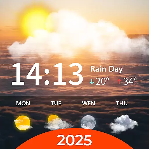
Your Personal Weather Assistant
4.00
User Reviews