


Zoom Earth is a premier interactive weather map application that provides users with real-time global weather updates and hurricane tracking. The app aggregates data from multiple satellite sources, including NOAA GOES, JMA Himawari, and EUMETSAT Meteosat, to deliver near real-time satellite imagery every 10-15 minutes. This ensures users have access to the latest meteorological information.
In addition to its satellite capabilities, Zoom Earth offers advanced forecasting tools. Users can explore detailed weather forecast maps covering precipitation, wind speed, temperature, and atmospheric pressure. The app's hurricane and wildfire tracking systems provide critical information for monitoring severe weather events and natural disasters as they develop, making it an essential tool for both casual users and emergency management professionals.
The application also features customizable settings, allowing users to adjust units of measurement, time zones, and animation styles to suit their preferences. With its comprehensive weather data and user-friendly interface, Zoom Earth delivers significant value to anyone needing reliable and up-to-date weather information.
Zoom Earth stands out through its diverse range of innovative features tailored for weather enthusiasts and professionals alike. One of its core functionalities is the interactive weather map, which displays various meteorological phenomena such as rain, snow, wind, and temperature in real time. These maps are powered by leading weather models like DWD ICON and NOAA/NCEP/NWS GFS, ensuring accuracy and reliability in forecasts.
A key highlight is the app's best-in-class hurricane tracking system. Updated with the latest data from authoritative sources such as NHC, JTWC, NRL, and IBTrACS, this feature allows users to monitor tropical storms from formation to category 5 hurricanes. Similarly, the wildfire tracking system uses NASA FIRMS data to detect high-temperature zones and track smoke movement via GeoColor imagery, providing crucial insights into fire-prone areas.
Customization options further enhance the user experience. Users can personalize temperature units, wind speed formats, time zones, and animation styles. For those seeking additional functionality, Zoom Earth Pro offers extended features through subscription plans, making it a versatile tool for both casual observers and serious meteorologists.
Forecast accuracy and data credibility are crucial for any weather application, and Zoom Earth excels in these areas. The app provides continually updated weather forecast maps using the latest model data from reputable sources like DWD ICON and NOAA/NCEP/NWS GFS.
Users can explore various interactive visualizations such as precipitation forecasts, wind speed and gusts, temperature, 'feels like' temperatures, wet bulb temperatures, relative humidity, dew point, and atmospheric pressure. These detailed and scientifically-backed forecasts allow users to plan their activities with confidence, knowing they have reliable information at their fingertips.
The satellite imagery on Zoom Earth is updated every 10 minutes, providing near real-time data that enhances the accuracy of weather predictions. This ensures that users receive timely updates about developing weather conditions, including hurricanes, storms, wildfires, and more.
By offering high-definition images twice a day from NASA polar-orbiting satellites Aqua and Terra, alongside frequent updates from geostationary satellites, Zoom Earth guarantees both precision and reliability in its weather data. This empowers users to make informed decisions based on credible and current meteorological information.
Zoom Earth offers an extensive temporal and spatial forecast range, enabling users to stay informed about weather conditions across different timeframes and geographical locations. The app's global forecast maps cover a wide array of meteorological parameters, ensuring comprehensive coverage no matter where you are located.
With features like rain radar and nowcasting, users can anticipate short-term weather changes in their immediate vicinity. This instant forecasting tool uses ground-based Doppler radar to detect rain and snow, giving users a precise understanding of impending weather events within their local area.
In addition to localized forecasts, Zoom Earth tracks large-scale phenomena such as hurricanes and wildfires. The hurricane tracking system provides clear and easy-to-understand information, updated in real-time using the latest data from authoritative sources like NHC, JTWC, NRL, and IBTrACS.
For wildfire monitoring, the active fires and heat spots overlay shows high-temperature points detected by satellite, updated daily with data from NASA FIRMS. Combined with GeoColor satellite imagery, this feature allows users to observe wildfire smoke movement and monitor fire weather in near real-time, enhancing situational awareness over larger areas.
Real-time weather updates
Accurate hurricane tracking
Detailed forecast maps
Interactive satellite imagery
Customizable settings
Premium features require subscription
Limited offline functionality
High data usage for live updates
Interface may overwhelm beginners
Occasional delays in image updates

Live local weather updates: various widgets & radar maps & hourly forecast.
 4.70
4.70
Live weather forecast for your everyday life
4.60
Know the weather earlier.
3.90
Track rainfall totals with ease using our rain gauge app. Accurate rain tracker.
4.50
Instant weather updates, easy to check anytime on your home screen.
3.50
Accurate weather forecast, daily weather changes are easy to grasp
4.90
Quickly check the Hanalei river gauge height during heavy rains on Kaua'i.
4.0
Weather radar, hyperlocal tracker and weather maps: follow your weather station
4.80
My Aurora Forecast Pro is the app for the Northern Lights and Aurora Borealis.
4.70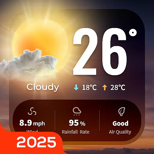
Your Trusted Weather Companion
4.40
Hyperlocal Forecasts, Live Radar, Severe Weather alerts & Homescreen Widgets
4.30
Live NOAA weather app to track storm, rain, wind, lightning & real local updates
4.20
Your Reliable Weather Companion
4.10
A powerful weather forecast to get real-time weather information
3.60
Detailed weather info and moon phase, subtle animation, customizable
4.1
User Reviews